Determine if map coordinates are within area

EvonS

Board Regular
Joined
Jun 1, 2016
Messages
111
Office Version
  1. 365
Platform
  1. Windows
  2. Web
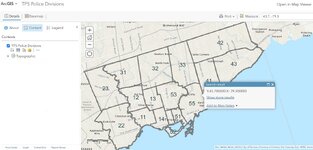
I have this information below that define areas on a map. Is there a way to determine if a longitude and latitude are within one of these areas?

OBJECTIDAGENCYDIVUNIT_NAMEADDRESSCITYAREA_SQKMShape__AreaShape__Length
1​
Toronto Police ServiceD1111 Division2054 Davenport RdToronto
18.67845803​
35692935.07​
28190.11106​
2​
Toronto Police ServiceD1212 Division200 Trethewey DrToronto
24.78034332​
47417573.68​
33029.13457​
3​
Toronto Police ServiceD1313 Division1435 Eglinton Av WToronto
18.60191063​
35591722.93​
24616.57917​
4​
Toronto Police ServiceD1414 Division350 Dovercourt RdToronto
14.17525415​
27083979.14​
30017.70564​
5​
Toronto Police ServiceD2222 Division3699 Bloor St WToronto
68.12188386​
130097609.1​
72765.03189​
6​
Toronto Police ServiceD2323 Division5230 Finch Av WToronto
57.64228008​
110369052.3​
54270.05361​
7​
Toronto Police ServiceD3131 Division40 Norfinch DrToronto
42.66749447​
81789149.85​
44477.14656​
8​
Toronto Police ServiceD3232 Division30 Ellerslie AvToronto
61.06048027​
117079222.9​
43658.49725​
9​
Toronto Police ServiceD3333 Division50 Upjohn RdToronto
52.7888815​
101244281.9​
45148.84874​
10​
Toronto Police ServiceD4141 Division2222 Eglinton Av EToronto
44.57511239​
85395988.8​
58875.05415​
11​
Toronto Police ServiceD4242 Division242 Milner Av EToronto
84.61174885​
162528804.9​
59824.09155​
12​
Toronto Police ServiceD4343 Division4331 Lawrence Av EToronto
59.37000474​
113873893.7​
54424.50711​
13​
Toronto Police ServiceD5151 Division51 Parliament StToronto
8.601682841​
16437802.1​
25324.5062​
14​
Toronto Police ServiceD5252 Division255 Dundas St WToronto
9.228055772​
17625448.21​
35966.54447​
15​
Toronto Police ServiceD5353 Division75 Eglinton Av WToronto
31.29485302​
59895251.81​
37395.46015​
16​
Toronto Police ServiceD5555 Division101 Coxwell AvToronto
41.03398633​
78486159.8​
82307.80296​
 

Excel Facts

Format cells as date
Select range and press Ctrl+Shift+3 to format cells as date. (Shift 3 is the # sign which sort of looks like a small calendar).
Well... No. Not with the data you posted. Is this coming out of ARCGIS? You asked if you can determine if the lat long falls within an area.

There are no lat long coordinates there. Using an API or something you could get the lat long from the address info.

But, even if you did that. What area are we talking about? Is there a shape file? It gives the Shape_Area and Shape_Length, but without the polygon information, those numbers are meaningless.

And I don't know how you would read a shape file with VBA.

Seems like you're re-inventing the wheel here.

Think you would be better off using ARCGIS. Or there are other free things like leaflet or mapbox. But, you would be getting into coding with Javascript or Python to use those.
 
Upvote 0
Well... No. Not with the data you posted. Is this coming out of ARCGIS? You asked if you can determine if the lat long falls within an area.

There are no lat long coordinates there. Using an API or something you could get the lat long from the address info.

But, even if you did that. What area are we talking about? Is there a shape file? It gives the Shape_Area and Shape_Length, but without the polygon information, those numbers are meaningless.

And I don't know how you would read a shape file with VBA.

Seems like you're re-inventing the wheel here.

Think you would be better off using ARCGIS. Or there are other free things like leaflet or mapbox. But, you would be getting into coding with Javascript or Python to use those.
Thanks for replying. Wanted users of my excel submission form to know who to submit the form to based on intersection data. But it sounds like it's not possible.
 
Upvote 0
I agree with the points made by @lrobbo314...this would require developing a solution that is already handled well by existing GIS systems.

For example, you can go to publicly available sources and see the police division boundaries and even download the shapefiles mentioned (the description of polygons for each division boundary). I believe I started by looking at:
...and by poking around, I discovered the shapefiles in various formats are available from the download button on the left side of that page.
But there is already an arcGIS-based viewer available online (found through links from that same website)...I eventually ended up here:
This allows a user to insert an address or even latitude-longitude coordinates in the Search bar to see where the location falls on the map. In this example, I entered lat-long coordinates of 43.7, -79.3 and discovered that it lies within the jurisdiction of D55.
Depending on your needs, you could use this web-based system, consider a similar GIS-based approach, possibly access a GIS system from Excel through an API, or download the shapefiles and create an algorithm to determine which polygon holds a given set of lat-long coordinates.
 

Attachments

  • Screenshot 2023-06-28 115015.jpg
    Screenshot 2023-06-28 115015.jpg
    230 KB · Views: 8
Upvote 0
Thanks. I am already using a submission form that collects the address so I was hoping to integrate this feature into the form itself. But it sounds like the easiest thing to do is to direct people to the website. Thanks for the help.
 
Upvote 0
As a thought, Powrquery can access websites and scrape data from them so in theory you could get the data into Excel, but I imagine its quite involved. Others may be able to comment more usefully.
 
Upvote 0
As a thought, Powrquery can access websites and scrape data from them so in theory you could get the data into Excel, but I imagine its quite involved. Others may be able to comment more usefully.
Can you be specific about what I would google re: power query to accomplish what you're suggesting?
 
Upvote 0
I believe that comment pertained to pulling shapefile information from the website into Power Query for further processing. If that is the case, you would still need an algorithm to evaluate whether user-inputted latitude-coordinates fell within the geographical boundaries of any of the TPS Divisions, and if so, which one. Quick update: I've already done the former--I pulled the shapefiles into PQ (although I didn't use the scraping feature...I manually downloaded the shapefile archive and processed it in PQ). Processing involved extracting the polygon descriptions for each division (i.e., lat-long coordinates for vertices of each cyclic polygon). After appending all of them together, along with a separate column to identify which division the coordinates belong to, the worksheet is over 24,000 rows. I've used those shapefile coordinates to construct bounding boxes for each division so that, given input lat-long coordinates, we can quickly determine which few divisions might contain the point of interest, while ruling out all other divisions. I'm currently looking into some approaches for examining each of the remaining possibilities to assess whether the point of interest lies within its boundaries. I'll post back with a link to the file after I make some more progress on this last step.

One critical question: what version of Excel are you using? Please update your account details to show this. I mention it because I've used convenient functions that are available in Excel 365 but not earlier versions.
Wow thanks for this support. I am using Office 365. I should mention that the user will be inputting streets for the intersection. I also have to figure out how to convert that to Long and Lat. Do you want a copy of the form I'm using?
 
Upvote 0
Thanks for the info. Inputting streets or addresses complicates matters, and you'll definitely need some way to perform the conversion from address to lat-long coordinates, probably through a custom function that relies on an API for a geolocation service. For now, I don't need to see the form, as I'm just trying to reliably identify a division number given two input cells (one for lat, the other for long).
 
Upvote 0

Forum statistics

Threads
1,215,223
Messages
6,123,711
Members
449,118
Latest member
MichealRed

We've detected that you are using an adblocker.

We have a great community of people providing Excel help here, but the hosting costs are enormous. You can help keep this site running by allowing ads on MrExcel.com.
Allow Ads at MrExcel

Which adblocker are you using?

Disable AdBlock

Follow these easy steps to disable AdBlock

1)Click on the icon in the browser’s toolbar.
2)Click on the icon in the browser’s toolbar.
2)Click on the "Pause on this site" option.
Go back

Disable AdBlock Plus

Follow these easy steps to disable AdBlock Plus

1)Click on the icon in the browser’s toolbar.
2)Click on the toggle to disable it for "mrexcel.com".
Go back

Disable uBlock Origin

Follow these easy steps to disable uBlock Origin

1)Click on the icon in the browser’s toolbar.
2)Click on the "Power" button.
3)Click on the "Refresh" button.
Go back

Disable uBlock

Follow these easy steps to disable uBlock

1)Click on the icon in the browser’s toolbar.
2)Click on the "Power" button.
3)Click on the "Refresh" button.
Go back
Back
Top